A Walk to Crawbuckie Preserve and Back – Old Croton Aqueduct

My plan had been to walk back into Ossining along Route 9/Albany Post Road. However, as I was walking to the diner, I noticed that the road crossed the Old Croton Aqueduct Trail.

According to New York State’s Parks, Recreation and Preservation site:

During the 1830s New York City was in dire need of a fresh water supply to combat the steady rise of disease and to fight numerous fires that often engulfed large tracts of businesses and homes. After numerous proposals and an abandoned plan two years into its production, construction of an unprecedented magnitude began in 1837 under the expertise of John Bloomfield Jervis. The proposed plan called for a 41-mile aqueduct and dam to be built in order to run water from the Croton River to New York City. Three to four thousand workers, mostly Irish immigrants earning up to $1.00 per day, completed the masonry marvel in just five years. In 1842 water flowed into above-ground reservoirs located at the present sites of the New York Public Library and the Great Lawn of Central Park. Throngs of people attended the formal celebration held on October 14th and celebrated with “Croton cocktails” – a mix of Croton water and lemonade.

This 19th-century architectural achievement cost New York City approximately 13 million dollars and was believed able to provide New Yorkers with fresh water for centuries to come. The population spiraled upward at a dizzying rate, however, and the Croton Aqueduct, which was capable of carrying 100 million gallons per day, could no longer meet New York City’s needs by the early 1880s. Construction of the New Croton Aqueduct began in 1885 and water began to flow by 1890. Although no longer the sole supplier of fresh water, the Old Croton Aqueduct continued to provide water to New York City until 1965.
In 1968, the New York State Office of Parks, Recreation and Historic Preservation purchased 26.2 miles of the original 41-mile aqueduct from New York City. Presently, Old Croton Aqueduct State Historic Park is a linear park which runs from Van Cortlandt Park at the Bronx County/City of Yonkers border to the Croton Dam in Cortlandt. In 1987 a section was reopened to supply the Town of Ossining and in 1992 the Old Croton Aqueduct was awarded National Historic Landmark Status. The scenic path over the underground aqueduct winds through urban centers and small communities. It passes near numerous historic sites, preserves, a museum highlighting the construction of the Aqueduct, and many homes. The Aqueduct’s grassy ceiling provides abundant recreational opportunities for outdoor enthusiasts. While primarily for walking and running, parts of the trail are suitable for horseback riding, biking (except during “mud season”), bird watching, snowshoeing, and cross-country skiing.


I’ve no idea what this structure is. Presumably it’s something to do with the Aqueduct. Notice in the second picture (below) my lightning like reflexes were able to capture a picture of a passing cyclist even though he came from behind me and I didn’t notice him coming until he passed me. 🙂


At times the trail crossed local roads. As I was passing this one a fire truck pulled up and backed into the station.


Eventually I got back to Ossining. A good view over the Weir house in the foreground towards the town center.


A view of the Weir house from the other side.


Two locals doing what most younger people seem to do all the time.


View looking back towards the Weir along the Aqueduct Bridge.

A stone aqueduct bridge was completed in 1842 to carry the Old Croton Aqueduct over both the Sing Sing Kill and the Broadway Arch Bridge. Designed by civil engineer John B. Jervis, the aqueduct carried fresh water from Croton Reservoir to New York City. The original Ossining weir was located a quarter mile north of the bridge but a program initiated in 1881 modified the function of the weirs to provide valves that could divert the entire flow of the aqueduct at any one weir. This was a feat not possible in the original 1842 design. All other weirs were modified but the original Ossining weir, located on a stream, could not accommodate the entire flow of the aqueduct. Therefore, a new weir was constructed in 1881-1886 at the Aqueduct Bridge where the water could be diverted.

The marker reads:

AQUEDUCT BRIDGE
COMPLETED 1842, OLD CROTON
AQUEDUCT CROSSES OVER
SING SING KILL & BROADWAY ARCH
BRIDGE. WEIR BUILT 1881-1886
TO EMPTY TUNNEL FOR REPAIRS.
WILLIAM G. POMEROY FOUNDATION 2022


View from the Aqueduct Bridge looking towards Ossining. The two churches are the First Baptist (on the left) and the First Presbyterian (on the right). More on them later.

Taken with a Sony RX10 IV.
A Walk to Crawbuckie Preserve and Back – Crawbuckie Preserve

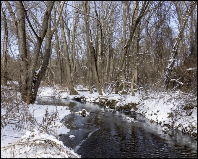
After a bit of a walk, I finally came to the entrance to the preserve. From there it was a fairly long downhill stretch which eventually brings you down to near the railroad tracks adjacent to the river. From what I’d read about the preserve I’d expected great views of the river. Indeed, there were some nice views, but as I was there to take photographs, I was rather disappointed. Almost all of views were obstructed by trees. In fact, I could see the river only because the trees were devoid of leaves. In Summer I probably wouldn’t have been able to see the river at all, except for a couple of views. In all honesty I can see better views from my local park (which is also on the river).


It’s a fairly small preserve and I don’t think I saw all of it. There doesn’t seem to be a lot to see. The only things that caught my attention were the boardwalks, and a rather intimidating flight of stone steps, some of which were quite tall. I’m 72 years old and was afraid I might fall a couple of times. The picture of the steps shows only about one third of them.


Still, although I was a bit disappointed photographically it was a pleasant short walk in the woods. Would I go back? If I lived close by, probably. But there are better woodland walks closer to where I live, So I probably wouldn’t.

Taken with a Sony RX10 IV.
A Walk to Crawbuckie Preserve and Back – Overview

According to InOssining.com

Ossining’s Crawbuckie Park / Nature Preserve is a woodland riverfront park and preserve accessible by car via Beach Rd. Parking is available at the entrance to the park’s trails, at the end of Beach Rd. The preserve is on the edge of Brayton Park, part of the North Village neighborhood.

Take a walk through the Edward M. Wheeler Crawbuckie Nature Preserve! For some beautiful early-morning light, start as much before 9:00 AM as you can muster the troops. Check out some pictures below.

There are 20+ acres of natural Hudson River Valley rain forest (it seriously looks like a rain forest in places) in this preserve. There are lovely trails that wind through the forest, where you will often see the river glimmering at you through the trees, and in some spots a more open Hudson River view. There are trees like cathedrals that are 3 and 4 feet in diameter. Some of these trees date back to when the area was home to Dr. Benjamin Brandreth’s 35-room mansion Glyndon.

A real highlight is the symphony of bird songs. Against the quiet of the woods their calls seem to be played through a loudspeaker. The preserve is populated by numerous bird species due to its huge diversity of trees. Ossining resident Robert Havell Jr. was the engraver for John J Audubon’s seminal work Birds of America (the “world’s most expensive book “). Audobon collected and studied in the Crawbuckie area.

But even though the purpose of my walk was to go to Crawbuckie I would pass much more along the way there and back: abandoned structures, strange festive decorations, an old home once owned by a very famous author. I would stop at a nearby diner for brunch and then continue along an historical trail into town. There I would take a short diversion to one of Ossining’s most famous monuments. By then I was tired and my feet hurt so another stop was in order, this time in a wonderful bookstore where I could sit an rest for a while. From there it was a relatively short, but unfortunately almost all uphill walk home.

Taken with a Sony RX10 IV

Walkway over the Hudson

A while back I went for a walk over the Walkway over the Hudson. It’s a steel bridge spanning the Hudson River between Poughkeepsie, New York, on the east bank and Highland, New York, on the west bank. Built as a double track railroad bridge, it was completed on January 1, 1889. A fire caused it to be taken out of service in 1974. It was reopened on October 3, 2009, as a pedestrian walkway, part of the Walkway Over the Hudson State Historic Park. It claims to the world’s longest elevated pedestrian bridge.

Even though it opened it 2009, this was my first visit. I was impressed by the stunning views.


Sojourner Truth Statue


Downtown Poughkeepsie


Taken with a Sony RX10 IV

A visit to upstate New York and Vermont – Fort Ticonderoga – Mount Defiance

In an earlier post I urged readers to look for a flag on a nearby hill. That hill is actually Mount Defiance. This view of Fort Ticonderoga was taken from there.

“Mount Defiance is an 840 ft (260 m) high hill on the New York side of Lake Champlain, in the northeastern United States. It is notable in that the hill militarily dominates both Fort Ticonderoga and Mount Independence, but it was deemed inaccessible so never fortified. Mount Defiance was previously known as Sugar Loaf.” (Wikipedia).

In the 1777 Siege of Fort Ticonderoga, the British army succeeded in positioning artillery on Mount Defiance, causing the Continental Army to withdraw from both forts without a fight.


And with this final wonderful view (below) of Lake Champlain from Mount Defiance we ended our visit to Fort Ticonderoga and headed off to our next destination, also in Ticonderoga, NY.

Taken with a Sony RX10 IV