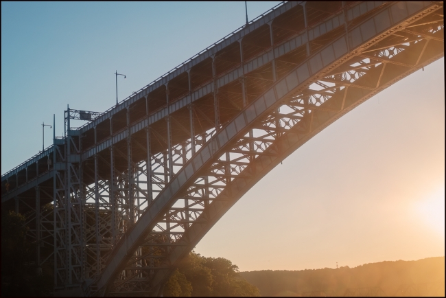
View home of the Henry Hudson Bridge near Spuyten Duyvil Metro North Station taken while returning home from NY City.
A bridge at this location was proposed as early as 1906, but Spuyten Duyvil residents and other civic groups opposed the bridge, arguing that it would destroy the virgin forest of Inwood Hill Park and bring traffic congestion to Bronx communities. Robert Moses preferred the route along the Hudson River because he was able to receive the land to build the Henry Hudson Parkway at no cost and use federal labor to build the parkway. The construction of the bridge helped open the Riverdale neighborhood to development.
The bridge was designed by David B. Steinman, drawing upon his 1911 Ph.D. thesis in civil engineering at Columbia University. Named to commemorate the voyage of Henry Hudson on the Half Moon, which anchored near the site in 1609, it was the longest plate girder arch and fixed arch bridge in the world when it opened in 1936.
The bridge has two roadway levels carrying a total of seven traffic lanes and a pedestrian walkway and spans Spuyten Duyvil Creek just east of where the tidal strait meets the Hudson River. The bridge is part of the Henry Hudson Parkway, New York State Route 9A. To its west, at five feet above water level, is the Spuyten Duyvil Bridge, which is used by Amtrak trains to Albany, New York and other points north. The Spuyten Duyvil Metro-North station is under the Henry Hudson Bridge on the Bronx side.
The original single-deck structure was built for the Henry Hudson Parkway Authority by the American Bridge Company at a cost of $4.949 million and opened on December 12, 1936. The upper level of the bridge was designed to be added at a later date and opened to traffic on May 7, 1938. The second deck was added at an additional cost of about $2 million, after toll revenues allowed its construction.
A rehabilitation project commenced in 2000 and was carried out by Steinman, Boynton, Gronquist and Birdsall, a successor of David B. Steinman’s firm. Repairs took place nearly continuously for at least a decade, at a cost of $160 million. The bridge was renovated from late 2017 to late 2020. The $86 million project replaced the last remnants of the original upper and lower decks, reopened the pedestrian and cycling path, eliminated the lower-level toll booth, upgraded roadway lighting, and made seismic improvements.
The bridge has two roadway levels carrying a total of seven traffic lanes and a pedestrian walkway and spans Spuyten Duyvil Creek just east of where the tidal strait meets the Hudson River. The bridge is part of the Henry Hudson Parkway, New York State Route 9A. To its west, at five feet above water level, is the Spuyten Duyvil Bridge, which is used by Amtrak trains to Albany, New York and other points north. The Spuyten Duyvil Metro-North station is under the Henry Hudson Bridge on the Bronx side (Adapted from Wikipedia).
“Spuyten Duyvil” may be literally translated as “Spouting Devil” or Spuitende Duivel in Dutch, a reference to the strong and wild tidal currents found at that location. It may also be translated as “Spewing Devil” or “Spinning Devil”, or more loosely as “Devil’s Whirlpool” or “Devil’s Spate.” Spui is a Dutch word involving outlets for water. Historian Reginald Pelham Bolton, however, argues that the phrase means “spouting meadow”, referring to a fresh-water spring at Inwood Hill.
An additional translation, “to spite the Devil” or “in spite of the devil”, was popularized by a story in Washington Irving’s A Knickerbocker’s History of New York published in 1809. Set in the 1660s, the story tells of trumpeter Antony Van Corlear summoned by “Peter de Groodt” to warn settlers of an attempted British invasion, with Corlear attempting to swim across the “Harlean river” from Fort Amsterdam to the Bronx mainland “in spite of the devil (spyt den duyvel)”, Irving writes. The treacherous current pulled him under and he lost his life. This resulted in the name “Spuyten Duyvil” for “the adjoining promontory, which projects into the Hudson.”
The creek was referred to as Shorakapok by Lenape Native Americans in the area, translated as “the sitting down place” or the place between the ridges”. (Adapted from Wikipedia)
Taken with a Fuji X-E3 and Fuji XF 35mm f1.4 R

