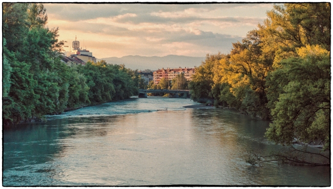
The River Arve separates Carouge from the rest of Geneva. This picture is taken from the Pont de Carouge looking in the direction of the Arve’s confluence with the River Rhone just west of center of Geneva.
According to Wikipedia:
The river Arve (French: L’Arve) flows for approximately 100 km (62 miles) through France, in the département of Haute-Savoie, and (for a few kilometers) in Switzerland. It is a left tributary of the Rhône.
Rising in the northern side of the Mont Blanc massif in the Alps, close to the Swiss border, it receives water from the many glaciers of the Chamonix valley (mainly the Mer de Glace) before flowing north-west into the Rhône on the west side of Geneva, where its much higher level of silt brings forth a striking contrast between the two rivers.
The Arve flows through Chamonix, Sallanches, Oëx, Cluses, Bonneville, Annemasse and Geneva.
According to the French version of Wikipedia (translated from the original French):
The Carouge bridge is the sixth most upstream bridge of the Arve after its entry into Switzerland and the third bridge (after those of the Val d’Arve and the Fontenette) linking Carouge and Geneva. For a long time, it was the only bridge over the Arve over which the tram passed. Another line was inaugurated on the Acacias bridge (seen in the distance in the picture) downstream on 15 December 2004.
The first vestiges of bridges over the Arve between Carouge and Geneva date from 100 BC. where two successive and parallel bridges represented the end of the road leading to Annecy. This already underlines the importance of Carouge as a road crossroads. In the eleventh century, the Bishop of Geneva initiated tolls on the bridge.
In the sixteenth century, the bridge marked the border between the duchy of Savoy and Geneva. It was deliberately built light for strategic reasons, sometimes lined with guard posts, several times swallowed up by the waves and quickly rebuilt even if it sometimes had to be replaced temporarily by a ferry. Unlike the Rhone bridge, positioned on the Island, the Carouge bridge was built at different locations over the centuries.
The present bridge was built under the name of “Pont-Neuf” in 1811 by the French government under the direction of engineer Nicolas Céard. It was modernized between 1816 and 1817, when Carouge joined the canton of Geneva following the Treaty of Turin signed with Savoy. Apart from an enlargement of the deck in 1862 to allow the passage of the tramway and the replacement of the granite slab pavement with asphalt in 1967, the bridge has not changed since.
Between 1935 and 1970, the flows of the Arve into the canton of Geneva were controlled at the Pont de Carouge. It was jointly owned by the city of Carouge and the city of Geneva. In 1974, the city of Geneva became co-owner with the State of Geneva, and in 1979 the town of Carouge took over from the Canton and in 1981 the bridge was renamed the “Pont de Carouge”
In 2016, a major renovation of the bridge was undertaken by the cities of Geneva and Carouge, owners of the bridge. This renovation began in February 2016 and lasted one year. A temporary walkway was put in place to allow pedestrians and bicycles to pass. The bridge was closed to all traffic (Vehicles and Trams) for two and a half months in summer 2016. The work consisted of demolishing and completely rebuilding and enlarging the deck of the structure, without detracting from the way the bridge looks.
This completes the series of pictures of the City of Carouge. It’s also a convenient place to take a break from this mountain of pictures from Geneva. So we’ll now head back to my usual stomping grounds in the Hudson Valley.

